


| Central Tien Shan |
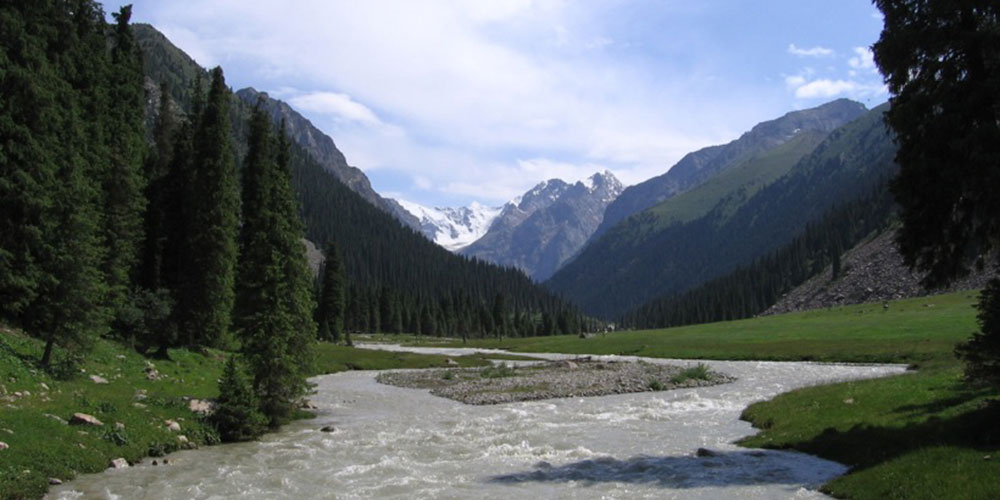
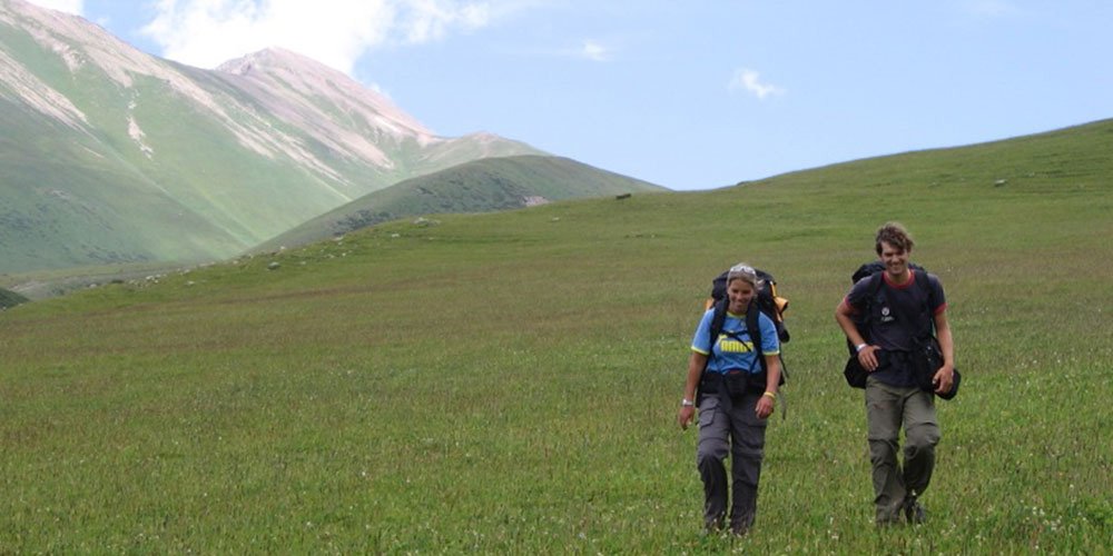
Beautiful and Post card perfect gorges of Karakol, Djety-Oguz, Altun-Arashan is excellent places for trekking, horse back riding and walks.
Central Tien Shan is one of the most severe in Kyrgyzstan. Weather conditions vary rapidly with bad weather staying for many days. Typically one or two days are required for snow to settle. Routes are mixed snow and ice.
There are stationary base camps in this area of Inylchek glacier. Helicopters operate regularly to these base camps. Without the use of helicopters 'walk ins' are several days.
Kaindy Glacier is situated to the south west of the Inylchek Glacier. This area is not visited as frequently as other areas of the Central Tien Shan and there are a large number of virgin peaks. The first ascents in this area were made in 1995. The area around the Kaindy Glacier suffers from similar weather patterns to the area round the Inylchek Glacier. Again helicopters are required for accessing this area.
Kok Sha'al-To'o range
The Kokshall Too is a mountain range beginning east of the Kyrgyzstan-Chinese frontier then running southwest and demarcating these two countries until it peters out at the Turugart Pass. It is the most southern range of the Central Tien Shan and culminates in Peak Pobeda, the second highest mountain in the former Soviet Union at 7,439m and lying south of the well-known Inylchek Glacier. The area was a closed military region until the late 1990s when some of the first expeditions went into the region. The Soviets had climbed the higher peaks, notable peaks Dankov (5982m) and peak Kizel Asker (5842m), but the region as a whole had not been well explored by climbers.
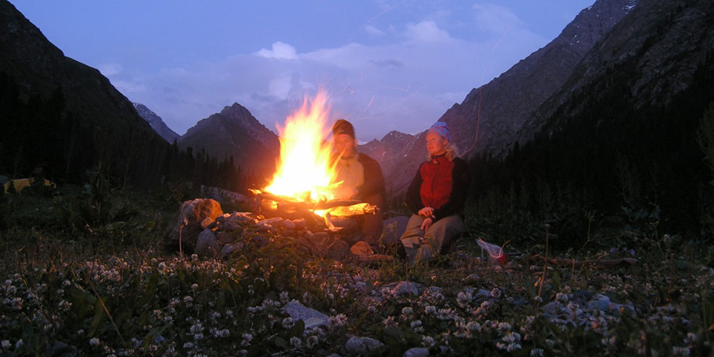
In the late 1990's few foreign expeditions traveled to the region to climb peaks and claim new routes. But all groups that have come, spent many days snowbound in a tent hoping for better weather tomorrow. If there is a weather window it is mid-August to mid-September. At times the weather is perfect, allowing runs up peaks, so the plan for the region has to be to get there, get up close to the objective and be ready to have a go when the weather clears.
Western Kok Sha'al-To'o range
Culminating in the 5,982m peak of Dankova, the most interesting
section of the Western Kokshaal-Too is around 50km in length and contains 80
or so summits over 4,000m. Due to its strategic position along the Chinese border
and close to a number of easy crossing points, military security had always
made access extremely difficult during the Soviet era. After Perestroika these
restrictions were to a certain extent withdrawn but most climbers were then
unable to finance the travel to such remote ranges. Because of this, very few
parties have ever climbed in the range and until 1996 the only routes achieved
had been by Soviet mountaineers taking part in the elite Russian Competition
system. This had resulted in some extremely hard climbs.
The eastern end of this massif, where the Dankov group is to be found, appears to be composed of a type of limestone and some metamorphic rock which is generally of very poor quality. Having somewhat easier access than the western sector and a military post in close proximity, plus offering the highest summit, may be the reasons why this part of the range has received the majority of expeditions (still very few). In contrast, the western end, broadly defined by the 5,842m peak of Kyzyl Asker and largely composed of excellent granite, needs to be approached from an entirely different direction and has received less attention. Special military permission is needed to go into this area and to obtain this requires having a reliable agent in Bishkek, not an easy task.
Getting there
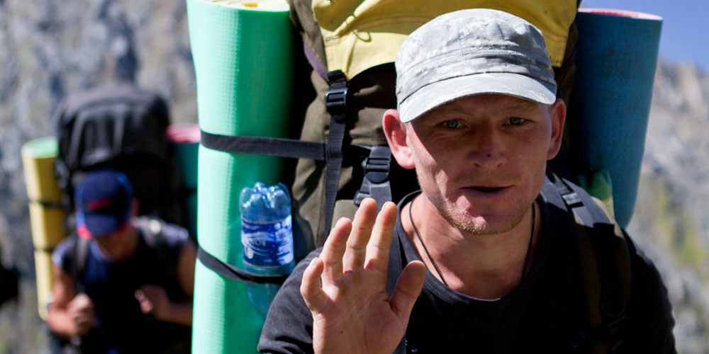
As in any range in Kyrgyzstan, you can always hire a helicopter and get there easy, if you have the money to do that you can skip this section. For the rest of us poor folk arriving to the region it entails a long drive from Bishkek, through Naryn, three military checkpoints and a final 10km over wet grass that may leave you completely stranded. Ok, all that in more detail.
First step is of course to get all of your paper work organised in Bishkek. Do not even try to do this yourself, an agency will need to do this ahead of time for you. The Kok Sha'al-To'o is a military border zone and not a place you can just wander into. Once you have the paperwork you can start driving. Best option is to hire a 4 wheel drive vehicle that will stay with you for your entire stay. The driver can also be base camp person. Do not expect you can leave your base camp unattended. There are very few locals living in the valley, but the local military may do patrols and it's best to have somebody at your camp at all times.
Drive from Bishkek to Naryn, approximately 5 hours. Be sure to buy all of you dry and canned foods and other supplies in Bishkek. There is very little available in Naryn except for final items such as bread, meat and vodka. You will most likely have to spend two nights in Naryn with at least one full day taken up getting signatures from local military officials. There is very little to do in Naryn, there is one main street with one trolley bus line running down the center.
Once the paperwork has been completed you drive toward At Bashy, but take a left before arriving on a road to the village of Bosogo. In the end we know that any road directions we give here will be inadequate later. Usually in Kyrgyzstan you need to routinely stop and ask anyway, so we will not wasted a lot of space with directions. There are three military posts before you arrive to Kok Sha'al-To'o range. These stops are all friendly document checks with no hassles. A nice thought is to bring cigarettes for the soldiers, they are bored and poor so cigarettes are appreciated.
After the final checkpoint there is nothing but road and mountains and this one long fence that goes the entire way. A question for sure needs to be asked, were they keeping people out, or keeping people in? All we can say for sure is that these are the forbidden mountains, the no man land between two huge superpowers, no open for climbing, that in itself is cool.
If you leave the city of Naryn early in the morning you will be
pulled into the mountainous region by late afternoon. The final few kilometers
of the journey is by far the most treacherous. You must drive parallel for many
miles along the wire fence. The road is in terrible condition with most of the
bridges washed out. At some point you will have to take a right over open territory
to get closer to the mountains where you can set up a base camp. Many of expeditions
have been defeated by these final few kilometers by getting stuck in deep mud.
To get to the Kyzyl Asker mountain group be sure to continue driving
until the peak of Kyzyl is directly to your right. There will be a large rock,
a mean a really large glacier deposited rock on the right side of the road,
this is the place where you need to take a right on a barely perceptible road.
The road will disappear and you will have to continue over open field. There
is no set route. There is an obvious area where to drive further is pointless.
Here you will need to find a stream of fresh water and a level area for camp.
Terskei Ala-To'o
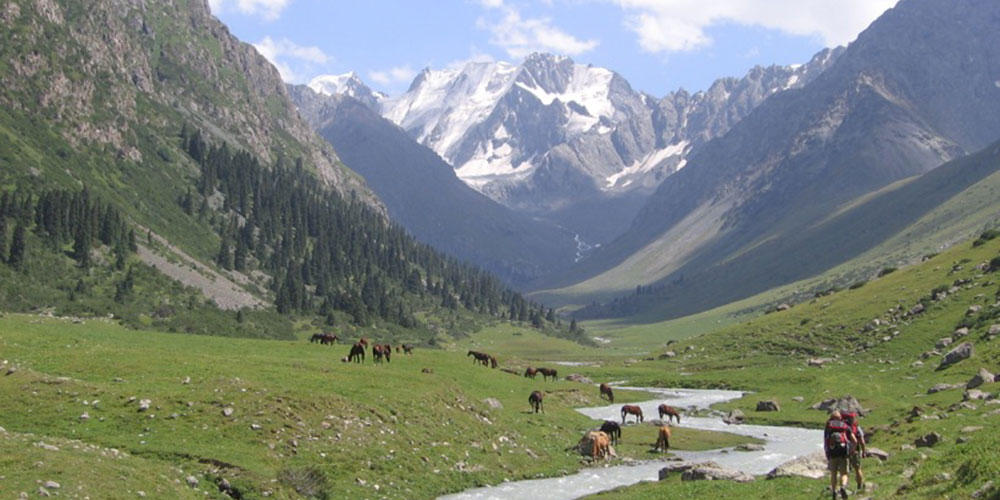
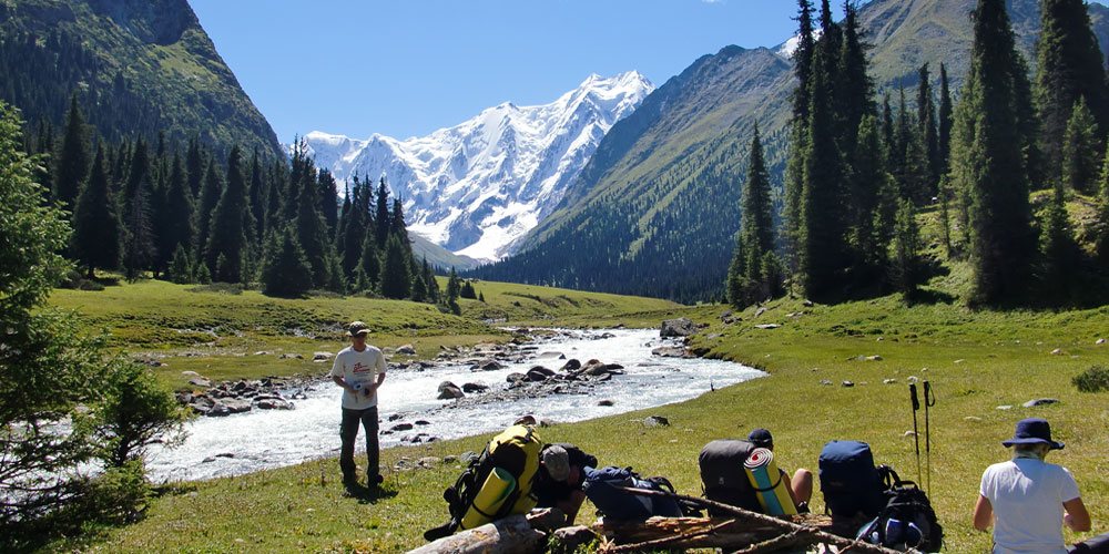
Terskei Ala-Too range stretches for 300km's along the southern coast of Issyk-Kul lake. Its northern slopes include several large gorges which provide some of the best trekking and moderate climbing in all of Kyrgyzstan. Most everybody that goes to this region talks of the amazing wilderness, variety of flora and fauna, alpine lakes, and friendly people.
The largest mountains here are over 5,000m and the area contains around 200 routes of varying degrees of difficulty. Routes tend to be mixed rock and ice on walls up to 1,500m. Most notable peaks here are Karakol 5218 m, Oguz-Bashi 5118 m, Djigit 5020 m, Aksu 5020 m.
The area is also known for various trekking possibilities in green and post card perfect valleys of Altyn-Arashan, Ak-Suu, Karakol and Djety-Oguz.
The climate is considerably milder than in the rest of Central Tien Shan, although precipitation is higher (1600mm p/a). Most of the rain falls during the beginning of summer but July and August are also characterised by frequent snow and thunderstorms. The most stable weather is during September.
The area can be reached by car or public transport which run constantly year round from the new bus station in Bishkek. Take a bus or taxi to Karakol town. From the bus station the center is a 15 minute walk, or a taxi can take you to your hotel. From Karakol the mountains rise above the city, a starting point for a trek or base camp for climbing will only be a short drive away.
Kuilu
Kuluu is a valley for the trekker and climber looking for good weather and moderate climbs up to 5200 meters. It is also a very remote region where no permits are required, a bonus for those looking for less hassle.
Kuluu is an overlooked valley tucked in the mountains south-east of Karakol. Most trekkers to this region either go right from Karakol to the mountains, or drive right passed Kuluu on their way to the Inylchek glacier and the peaks of Khan Tengri and Pobeda. The valley is long and rounded, with many side valleys of interest to hike into. The most dramatic side valleys are near the end of the valley.
The valley is mostly deserted, along the way in there is one meteorological station and perhaps five homes of local farmers. At the very end of the valley, in the picture above it can just be seen, is a small house and ranch where one family lives. They have a subsistence existence, living only on a small garden and meat and milk products. Nevertheless they were more than welcoming and often invited us in for tea and a piece for bread.
To get there drive to the city of Karakol on the eastern end of Lake Issyk-Kul, 8 hours from Bishkek, This is the last large city along the way. From Karakol head east, the road winds through many villages, but is always the main road in that direction. The road as it leaves the lower regions is very beautiful as it rises into higher country along a raging while water river. Then a high alpine meadow is reached, in summer full of yurts and horses. Continue along the road until you see an old bulldozer perched on a large boulder as a monument to those that built the road. Just passed the bulldozer is a left hand turn that leaves the valley. Then ascend the pass on a windy but well kept road. The pass is almost 4000m high, then descends down to a lower valley along a river, also here are many yurts and herds of sheep. Once on the valley floor the road will intersect the Kuluu river. Just in the distance a military post (often deserted) can be seen, to continue would require a permit.
At the intersection of the Kuluu river be sure to take the road on the right side of the river (looking upstream). This road continues to the end of the valley. You could take the road on the left side of the river and continue for about 10 kilometers to the meteorological station, as of 2000 there was somebody living there so it could be a good place to leave your car and start a trek. Horses also may be available here but this shouldn't be rely on. The left hand side of the road ends shortly past the station.
The right hand side of the road continues for 37 kilometers until the place where the river branches at the head of the valley. The road is almost non-existent at times and several times you will have to get out and throw rocks into washed out sections of the road. At the end of the valley, 37 km in, the road ends at a river crossing (In short try to drive as far as a vehicle can travel into the valley). Here is a perfect place to set up a base camp and explore for climbs and hikes in the region. A trek could be organised from here that goes back to Karakol that would be fantastic, or base yourself at the head of the valley and go on shorter treks.
From Base camp there are three main directions, straight up the valley to a region of several peaks in the mid 4000m range, left up the Karator glacier where the peaks rise to just over 5000m, or right which could lead to trails back to Karakol.
Kuluu does not offer the most dramatic walls and high peaks in Kyrgyzstan, but it does offer remoteness without permits and good climbs without major transportation issues. The first climbing expedition to the region was only in 2000 by a group led by Pat Littlejohn, a British mountaineering guide. They climbed most of the obvious peaks in the area.
Karator is the region most suitable for routes. There are several relatively easy walk ups that at most require basic glacier equipment, as well as good moderate walls of mixed rock and ice. Most of the lines on the faces have yet to be climbed.
Ak-Shiyrak
Ak-Shiyrak is the second largest glaciation area of Kyrgyzstan after Kok Sha'al-To'o range. It is placed just behind the middle part of Terskei Ala-To'o range which rises above Karakol town. The range is measured by 60km long and 28 km across and has very typical alpine appearance with narrow rocky ranges dividing large snowfields of valley glaciers.
"Shiyrak" is the Kyrgyz for shank, shinbone. "Ak-Shiyrak" means white feet related to sheep and other artiodactyls.
Average altitude here is 4700 m above sea level, highest point is at 5126m. Besides this peak there are also 4 summits over 5000 m above sea level. 46% of the total area of Ak-Shiyrak occupied by glaciers, the total number of glaciers is 48 or about. The most noticeable are Petrov glacier (11km), North Karasai (12km), Djaman Suu (10km) and some others.
Ak-Shiyrak is a little explored range, only a few expeditions have visited the area before and climbed some peaks remaining hundreds of others untouched. The highest point of Ak-Shiyrak is at 5126 m. A virgin and nameless peak in eastern part of the range. Except the several relatively easy walk ups that at most require basic glacier equipment there are also good moderate walls of mixed rock and ice. Most of the lines on the faces have yet to be climbed. The area is also considered to be a right place for heli skiing and boarding.
Climate of the region is sharply continental, dry and abnormally inclement. In October frosts can reduce temperature to -20, in winter time -50 is considered to be normal.
To get there you will need to hire a 4WD vehicle, then drive west of Karakol town to Barskaun valley by good road. This leads to the Canadian gold mine factory operating in Kyrgyz mountains. The road is under control of factory security, if you stopped, explain them that you are not going to dig the gold in fabric's surroundings either visit its territory and go on. At some point the road turns left to the factory, you go straight ahead over the pass of Suek (4021 m). Sometimes the road can be washed out and you will need to throw stones in the holes in order to give a drive. Follow the main road to the village of Kara-Sai. The range on the right side is Ak-Shiyrak. Approaches can be made by the river beds of Kara-Sai, Taragai or Uch-Kel which separate Ak-Shiyrak range from Kuilu range. Visiting Ak-Shiyrak require a border zone access permit which can be easily organised through a travel agency along with other logistics.
Other ranges
There are a number of little explored ranges in Central Tien-Shan amongst others Borkoldoi, Djetim, Djetim-Bel, Djangy-Djer. The valleys provide trekkers and climbers with good weather and moderate climbs up to 5000 meters. It is also a very remote regions where no permits are required, a bonus for those looking for less hassle.
If you are interested in some of the treks or jeep tours in Tien-Shan please contact us for futher details.
Please note that this page is not a complete climbing guide to the region.
Remember that some areas should be avoided unless you are on organized tour with a local guide who knows the area.